Teaching What’s Important
I was on the 5:46 train from Manhattan to Westchester yesterday. The first stop was White Plains and almost everyone gone off. A lot of people were standing, including me. Two of the other guys standing were 20-somethings who, given my eavesdropping, seemed to have entry-level-ish sales jobs. Somehow or another, they started talking about population density, wondering aloud which state had the lowest. We were underground, so it was going to be a few minutes before one of the could fire up an iPhone web browser and Google their way to a Wikipedia entry. Instead of just accessing the answer within a minute or two, they swapped speculation.
* * *
Earlier in the day, I read this article about the incredibly large amount of homework that middle schoolers get. It’s a great read, so click the link and take a moment to peruse it at least, or bookmark it for later or something. For now, though, focus on this part:
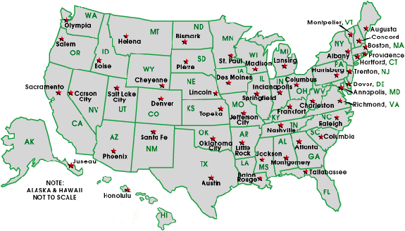
Another exercise required Esmee [the author’s daughter, then in sixth grade] to find the distance from Sacramento—we were living in California—to every other state capital in America, in miles and kilometers. This last one caused me to question the value of the homework.
What possible purpose could this serve?, I asked her teacher in a meeting.
She explained that this sort of cross-disciplinary learning—state capitals in a math class—was now popular. She added that by now, Esmee should know all her state capitals. She went on to say that in class, when the students had been asked to name the capital of Texas, Esmee answered Texas City.
But this is a math class, I said. I don’t even know the state capitals.
I don’t agree with the author here, generally. I don’t see an issue with cross-disciplinary learning and actually see it as a net positive good idea, although that’s definitely a lay opinion. (In fact, everything here is a lay opinion — I’m just a guy with a good head on my shoulders, and not an expert on education at any level.) If you’re going to learn how to measure distance in math class, which makes sense to me, it further makes sense that you’d be better off doing so with some sort of practical application attached. Now, state capitals is an odd choice, because there’s little practical application in knowing how far Sacramento is to Jefferson City, Missouri. The odds of that having any relevance in your life, especially as a 12-year-old, is roughly zero, so it probably doesn’t aid you in learning about the math. And it also doesn’t tell you anything important about the world at large.
In short, why does Esmee have to know her state capitals?
* * *
Wyoming.
That was the first state that popped into my head. Very small population — the smallest among the states — and relatively large in land area. That’s a great recipe if you want a low population density. And then I remembered Alaska.
The maps screw with our sense of things, I think. Alaska isn’t to scale in most any map you’ll see, for a variety of reasons. But it’s huge. It’s bigger than Texas. It’s bigger than California. It’s bigger than Montana. Sure. But did you know that it’s bigger than all three of those states — combined? Alaska is huge.
If you know that, even if it’s just a glib memory of that fact, Alaska is clearly the right answer — once you remember that Alaska is a state, which make take a moment. But that’s not what happened on the train. The two sales guys were talking, and one said “Alaska” and the other said “one of the Dakotas.” That’s not a terrible guess — the Dakotas rank 46th (South) and 47th (North) in population density. But they have an average population density of about 10 people per square mile, compared to about 1.25 people per square mile in Alaska. That’s an 8:1 ratio. West Virginia has a population density of approximately 77 people per square mile, which is (very roughly) a 7:1 ratio compared to the Dakotas. West Virginia is the 29th most populous state in the Union. The ordinal gap between the Dakotas and Alaska is incredibly misleading. Alaska is the least dense state in the U.S., and it isn’t close. At all.
* * *
The train was more crowded than usual but it wasn’t a big deal. The trip was about 45 minutes and while standing isn’t fun, it’s doable, even if you have to do it every day. (I typically get a seat, though.) By my count, there were about 125 people on my train car. There were eight cars. Less than ten minutes behind us, there was another train — the 5:51 — which I almost had to take because I barely made the one I was on. It was likely packed as well. That’s sixteen cars, each of about 125 people, all going to the same place at the same time and not really thinking much about it. Commuting is just part of the daily routine.
* * *
The population of Alaska isn’t evenly distributed. Of the 730,000 or so who live there, nearly 300,000 live in Anchorage. Fairbanks is second with about 31,500 and Juneau is third with 31,200 or so. Juneau is the capital. It is 2,464 miles (3,965 km) from Sacramento.
Juneau is tiny. My home state of Connecticut has 30 different municipalities with a large population. Juneau is roughly the size of Newington, Connecticut, which has about 30,500 residents. Newington is roughly 3,000 miles (4,828 km) from Sacramento. The number of people who care about that is roughly zero, because it’s wholly unimportant. The distance from Sacramento to Juneau is only marginally more important.
That’s because the mere fact that Juneau is Alaska’s capital tells you nothing about Alaska’s culture, demographics, or anything else. There’s a certain arbitrariness here — Anchorage has 40% of the state’s population and is ten times the size of Juneau. Would making Newington the capital of Connecticut make it important? Hardly.
The distance from Sacramento to Juneau is roughly (very roughly) the same as the distance from Sacramento the similarly town of Newington. That tells us nothing. We’re teaching the unimportant stuff and making it seem important.
* * *
After figuring out that Alaska was the least densely populated state, the two guys started wondering what the most densely populated state was. One said (with conviction) New Jersey, which is the correct answer, at 1, 205 people per square mile. The other guessed Rhode Island, which at 1,016 people per square mile, is second. It’s a solid guess, especially when you see that the drop-off to #3 (Massachusetts, 852 people per square mile) is rather large.
Rhode Island is slightly over a million people, which puts it 43rd in population among the states. It’s the smallest state by area, at about 1,200 square miles, which is why its population density ranks so high. No surprises there.
* * *
So let’s do some math. Just like Esmee had to. But instead of learning distances, let’s do some division and multiplication and fractions and that stuff.
- The population density of Alaska is 1.25 people per square mile.
- There are about 125 people on my train car.
- There are eight cars on my train, and I had my choice of two equally-crowded trains. So that’s 16 train cars.
Those last two bullets are my (basically) everyday life. It’s part of my culture and the culture of the entire Westchester area — even those who don’t commute. And if those of us on the train — not our families, neighbors, or friends, but just those of us commuting — had to spread out to match the population density of Alaska, we’d need 1,600 square miles. (Really, the math is easy.)
Rhode Island is only 1,200 square miles. We’d need one and one-third Rhode Islands, just for those of us who commute home from New York City to the White Plains area between 5:46 and 5:51 each afternoon. It’s pretty clear, from this, that Alaska is very, very different than the New York City suburbs I now live in. And to get there, I had to learn math. And when I did it, the math had meaning.
Shouldn’t this be how we teach?
Originally published on September 27, 2013